File:doppio tides Gulf of Maine.png
From WikiROMS
Jump to navigationJump to search
Size of this preview: 800 × 579 pixels. Other resolutions: 2,560 × 1,852 pixels | 3,358 × 2,429 pixels.
Original file (3,358 × 2,429 pixels, file size: 290 KB, MIME type: image/png)
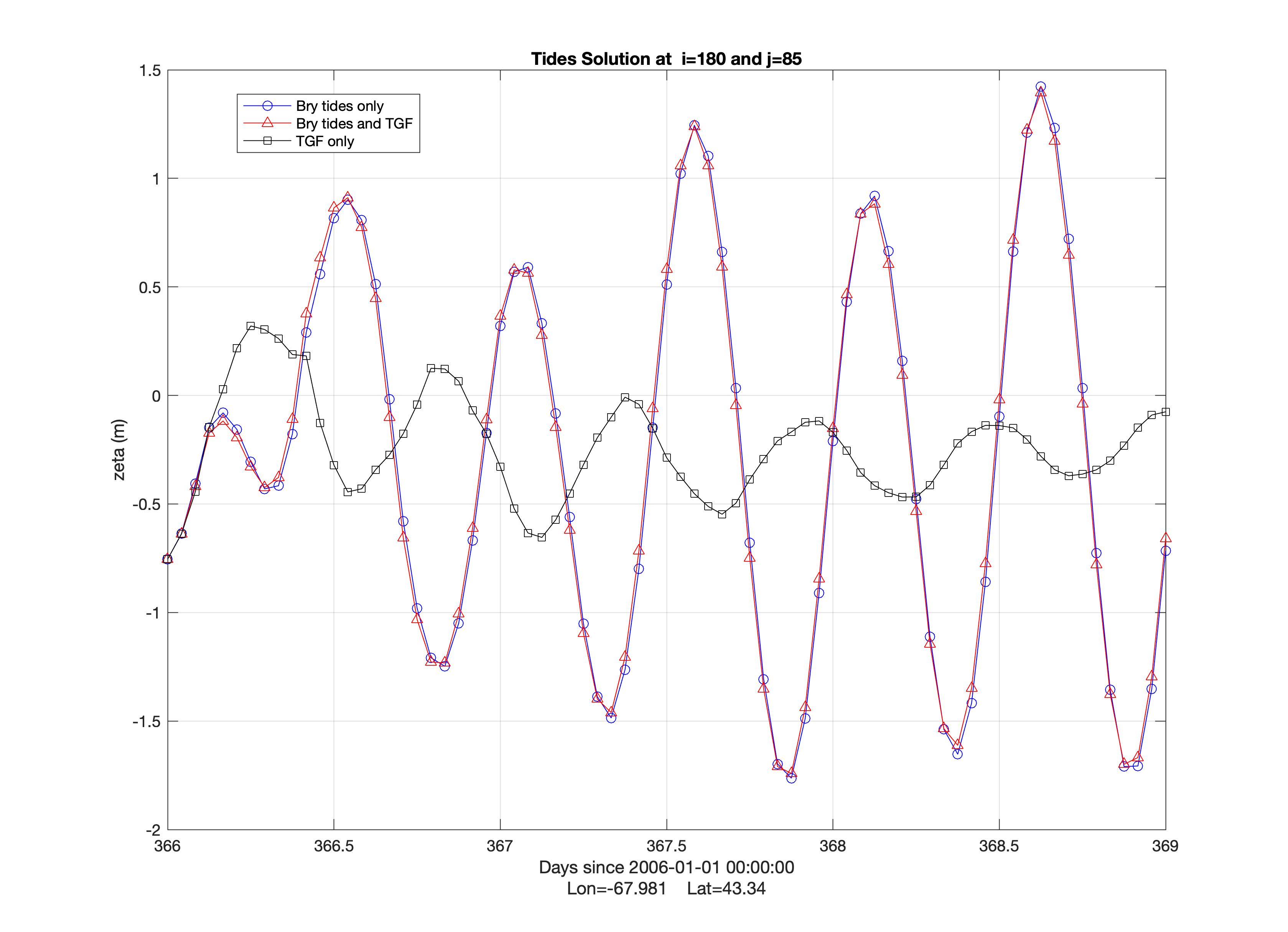
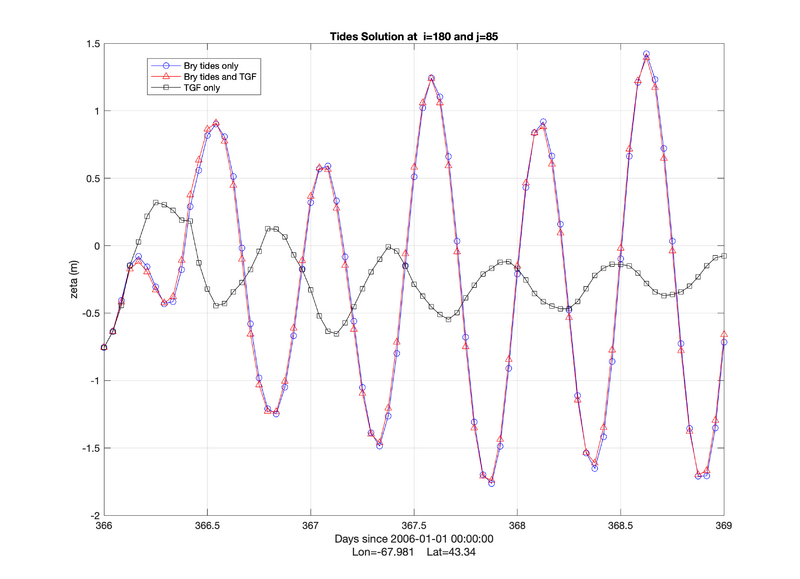
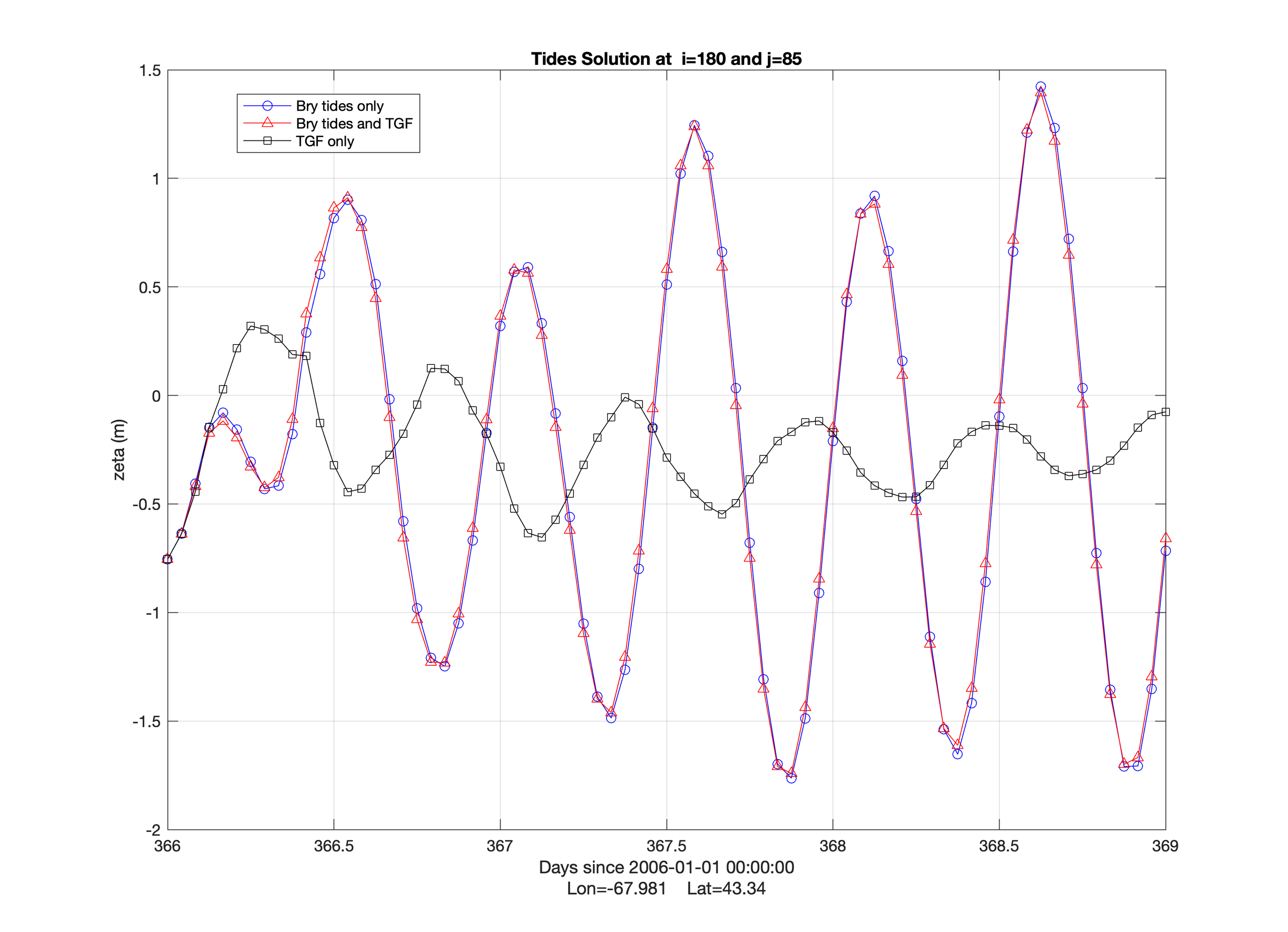
doppio sea surface elevation for the center of the Gulf of Maine. ROMS is configured with boundary tidal forcing, tide generating force, and inverted barometer effect in the pressure gradient.
File history
Click on a date/time to view the file as it appeared at that time.
| Date/Time | Thumbnail | Dimensions | User | Comment | |
|---|---|---|---|---|---|
| current | 22:14, 9 September 2021 | | 3,358 × 2,429 (290 KB) | Robertson (talk | contribs) | doppio sea surface elevation for the center of the Gulf of Maine. ROMS is configured with boundary tidal forcing, tide generating force, and inverted barometer effect in the pressure gradient. |
You cannot overwrite this file.
File usage
The following page uses this file: