Horizontal Resolution: 0.8º zonal; 0.4 to 0.6º meridional
Vertical Resolution: 20 s-levels (terrain-following).
Forcing: Currently under climatological forcing (NCEP).
Figure 1: December SST and surface flow for the Gulf Stream, Loop Current, and Labrador Current.
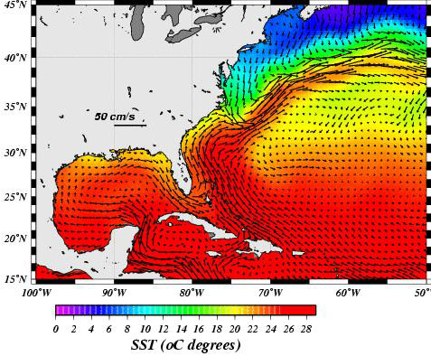
Figure 2: December Kuroshio and Oyashio currents.
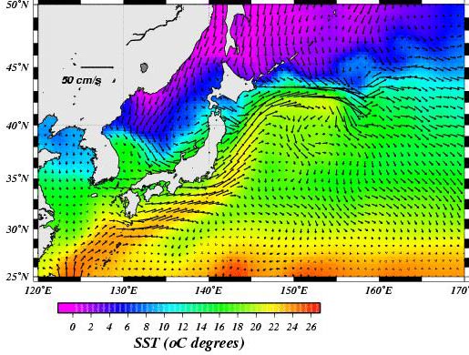
Figure 3: December Malvinas-Brazil confluence area.
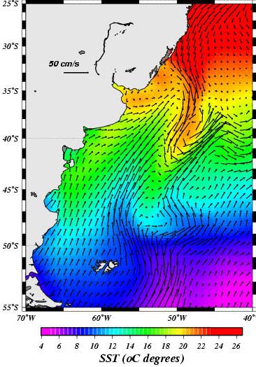
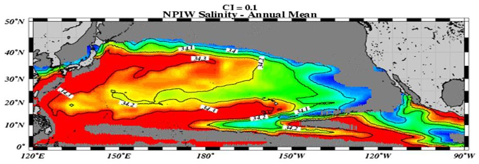
Figure 4: Tropical Pacific.
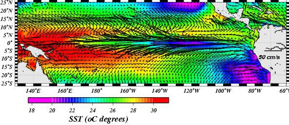
Figure 5: Agulhas and Benguela Currents Northern flank of the ACC (December).
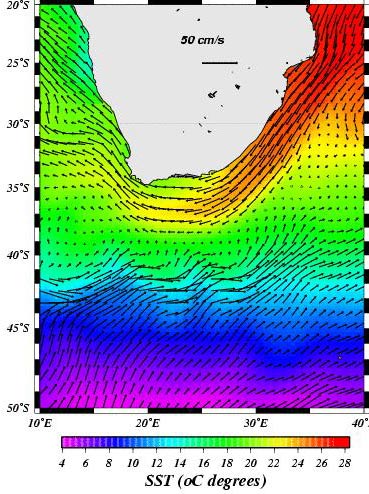
Figure 6: Norwegian and East Greenland Currents (December).
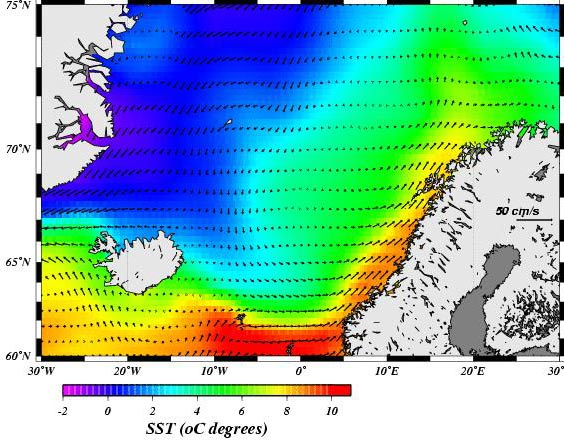
Figure 7: Annual mean Salinity of the N. Pacific Intermediate Water (depths range from 300 to 800 m). Definition: Salinity Minimum in a given salinity range.